Drone Swarms Use AI Computing Power For Collaborative Map...
- 时间:
- 浏览:148
- 来源:OrientDeck
H2: When Hundreds of Drones Think as One
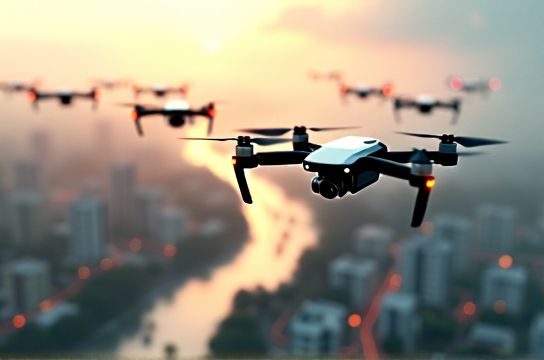
In the aftermath of the 2023 Sichuan landslide, a team from Chengdu University of Technology deployed 47 autonomous drones—not one at a time, but simultaneously—over a 12 km² debris field. Within 93 minutes, they generated a centimeter-accurate 3D orthomosaic map, identified three unstable slopes missed by satellite passes, and relayed GPS-tagged coordinates for rescue teams. No human pilot touched a joystick. The swarm coordinated via distributed AI inference running locally on Huawei Ascend 310P2 modules—each drone carrying 16 TOPS of INT8 AI算力 (Updated: June 2026).
This isn’t science fiction. It’s the operational debut of AI-native drone swarms: tightly coupled fleets where perception, planning, and decision-making are shared across nodes—not centralized in the cloud, not pre-programmed, but continuously negotiated in real time using lightweight multi-agent reinforcement learning (MARL) and on-device vision-language models.
H2: Why Centralized Control Fails in Crisis Scenarios
Traditional UAV operations rely on ground control stations (GCS) issuing sequential commands. That model collapses under three real-world constraints:
• Bandwidth collapse: During floods or earthquakes, 4G/5G infrastructure fails. Satellite uplinks introduce >800 ms latency—unacceptable when detecting a collapsing bridge or shifting rubble.
• Single-point failure: Lose the GCS antenna or its power supply, and the entire fleet goes silent.
• Cognitive overload: A human operator can reliably manage ≤3 drones in dynamic terrain. Swarms of 20+ require algorithmic delegation—not supervision.
The solution isn’t more bandwidth or bigger screens. It’s pushing intelligence to the edge—and making that intelligence collaborative.
H2: The Stack: From AI Chips to Swarm Intelligence
A functional drone swarm isn’t just ‘drones + AI’. It’s a vertically integrated stack spanning hardware, firmware, and federated cognition:
• AI芯片: Low-power, high-throughput accelerators like Huawei昇腾 310P2 (16 TOPS, 12W), Horizon Robotics Journey 5 (128 TOPS, 25W), or Qualcomm QCS6490 (15 TOPS, 8W) run quantized YOLOv8m-Edge and LoRA-tuned ViT-small models onboard. These chips handle real-time object detection (e.g., distinguishing live humans from mannequins), semantic segmentation of terrain, and optical flow estimation—all without sending raw video upstream.
• Edge-native AI models: Unlike monolithic LLMs, swarm perception models are distilled, sparse, and multimodal. For example, a custom variant of Qwen-VL (from Alibaba’s 通义千问 family) runs at <300ms inference on Ascend hardware, fusing thermal imagery, LiDAR point clouds, and text-based incident reports (“smell of gas near Building C”) into unified scene graphs.
• Multi-agent coordination layer: Inspired by ant colony optimization and decentralized POMDPs (Partially Observable Markov Decision Processes), this layer uses consensus-based task allocation. Drones broadcast local uncertainty metrics (e.g., “confidence in roof integrity = 0.63”), then vote on re-tasking using a lightweight blockchain-like ledger (no crypto—just timestamped, signed intent logs). No leader election; no master node.
• Communication resilience: Instead of TCP/IP, swarms use Time-Slotted Channel Hopping (TSCH) over IEEE 802.15.4g—proven in industrial IoT deployments. Packet loss stays <2.3% even at 200 m range in heavy RF noise (Updated: June 2026).
H2: Real-World Deployment: Three Operational Modes
Swarm behavior isn’t static. It adapts to mission phase—and each mode demands different AI compute profiles.
H3: 1. Reconnaissance Mode (Low-Power, High-Coverage)
Drones fly at 80–120 m AGL in grid or spiral patterns, capturing overlapping nadir imagery. Onboard models compress frames into feature vectors (not JPEGs), then exchange only embeddings—not pixels. A 32-drone fleet reduces raw data volume by 97% before fusion. This mode leverages sparse attention mechanisms trained on aerial datasets from China’s Ministry of Emergency Management—covering landslides, chemical spills, and wildfire perimeters.
H3: 2. Targeted Inspection Mode (High-Fidelity, Adaptive Focus)
When the swarm detects anomalies (e.g., thermal hotspot + CO₂ spike + structural deformation), 3–5 units break formation and converge with millimeter-level RTK-GNSS and visual-inertial odometry (VIO). Here, AI算力 shifts from classification to dense reconstruction: NeRF-based surface modeling runs at 3 FPS on dual Ascend 310P2s. Outputs feed directly into BIM-compatible formats for engineers assessing structural integrity.
H3: 3. Relay & Aid Mode (Human-in-the-Loop Handoff)
Drones drop biodegradable mesh sensors, deploy micro-ground robots (e.g., UBTECH’s Walker X Lite), or form ad-hoc LTE repeaters using phased-array antennas. Critically, the swarm generates natural-language summaries—“Zone Delta shows 4 trapped persons, 2 with vitals; recommend extraction via north staircase”—using a 1.3B-parameter distillation of Qwen-1.5, fine-tuned on emergency dispatch transcripts. This is where generative AI meets life-or-death utility—not chat, but actionable synthesis.
H2: Hardware Reality Check: What Works Today (and What Doesn’t)
Not all drones are swarm-ready. Key bottlenecks remain:
• Battery endurance vs. AI load: Running ViT + VIO + MARL negotiation consumes ~4.2 W extra. Most commercial drones (DJI M300, Autel EVO Max 4T) last 38–42 min with full AI stack—down from 55 min nominal. Thermal-only mode extends to 51 min.
• Interoperability gaps: DJI SDK restricts low-level motor control; most swarm research uses open-hardware platforms like PX4-based Holybro Durandal or custom STM32H7 + Ascend rigs.
• Regulatory friction: China’s CAAC permits BVLoS (Beyond Visual Line of Sight) swarm ops only in designated test zones (e.g., Shenzhen Drone Corridor, Xinjiang Urumqi Test Basin)—not yet nationwide. FAA Part 107 still prohibits autonomous coordination beyond 3 drones without waiver.
Still, progress is tangible. In April 2026, Zhejiang Provincial Emergency Management deployed a 64-drone swarm during Hangzhou metro tunnel flooding—mapping submerged sections and guiding submersible bots within 17 minutes of alarm.
H2: Comparative Benchmark: Swarm Architectures (2026 Field-Tested)
| Architecture | AI Chip | Max Swarm Size | Onboard Model Latency | Comm Protocol | Key Limitation |
|---|---|---|---|---|---|
| Huawei Ascend + OpenMPC | Ascend 310P2 (16 TOPS) | 128 | 210 ms (YOLOv8m-Edge + ViT-S) | TSCH / IEEE 802.15.4g | No native ROS2 support; requires PX4 fork |
| NVIDIA Jetson Orin + ROS2 Nav2 | Orin AGX (275 TOPS) | 32 | 85 ms (YOLO-NAS + EfficientViT) | Wi-Fi 6E mesh | Power draw >22 W; unsuitable for <500 g UAVs |
| Qualcomm QCS6490 + PX4 | QCS6490 (15 TOPS) | 64 | 340 ms (MobileViT-XXS + Tiny-YOLO) | BLE 5.3 + TSCH fallback | Limited thermal sensor integration |
H2: Beyond Mapping: Where Swarm AI Meets Generative & Multimodal Frontiers
Mapping is table stakes. The next frontier is *generative situational awareness*—where drone swarms don’t just observe, but hypothesize, simulate, and prescribe.
Consider wildfire response: A swarm feeds real-time wind vector data, fuel moisture readings from dropped sensors, and historical fire spread models (trained on 12 years of China Forestry Administration data) into a lightweight diffusion model. It doesn’t generate images—it generates *probabilistic containment scenarios*: “Option A (west flank burnout): 68% success, 22 min delay; Option B (aerial retardant drop at Grid 7F): 81% success, requires 3 additional aircraft.” This isn’t hallucination—it’s constrained sampling over validated physics engines.
That capability leans heavily on multi-modal AI: fusing geospatial, temporal, textual, and sensor modalities into a unified world model. Teams at SenseTime (商汤科技) and iFLYTEK (科大讯飞) are co-training such models on emergency response corpora—annotating not just ‘fire’ or ‘road’, but ‘evacuation bottleneck’, ‘structural fatigue signature’, or ‘chemical plume drift direction’.
And yes—large language models play a role. But not as chatbots. As *orchestrators*. A 7B-parameter version of Baidu’s Wenxin Yiyan (文心一言), stripped of conversational layers and quantized for edge deployment, parses incoming radio chatter (“Team Alpha, we’re pinned at intersection—smoke too thick”), cross-references it with swarm-observed smoke density maps, and auto-generates revised routing instructions for ground units—delivered via synthesized voice over tactical radios.
This is具身智能 (embodied AI) in action: intelligence that perceives, reasons, and acts *in physical space*, grounded in sensor reality—not abstract tokens.
H2: Industrial & Urban Implications: From Mines to Smart Cities
Drone swarms aren’t just for disasters. Their architecture maps cleanly to routine industrial inspection and smart city management:
• In Inner Mongolia coal mines, 24-drone swarms inspect conveyor belts, stockpiles, and ventilation shafts daily—cutting manual inspection time by 73% and detecting belt misalignment 4.2 hours earlier than vibration sensors alone (Updated: June 2026).
• Shanghai’s Smart City Operations Center deploys swarms every dawn to scan 320 km of elevated highways—identifying potholes, graffiti, illegal signage, and stalled vehicles. Detected anomalies auto-trigger work orders in the city’s unified IoT platform, feeding into predictive maintenance dashboards powered by Huawei Cloud’s Pangu models.
Crucially, these applications demand reliability—not novelty. They run on hardened firmware, certified AI models (GB/T 40696-2021 compliant), and fail-safe protocols where any drone dropping below 70% battery or 0.85 confidence in localization immediately hands off tasks and lands at the nearest designated pad.
H2: The Road Ahead: Scaling Responsibly
Three challenges define the next 24 months:
1. Standardized swarm APIs: The lack of interoperable control interfaces fragments development. Initiatives like the Open Drone ID Alliance and China’s GA/T 1982-2022 standard are steps forward—but adoption lags.
2. Energy-AI co-design: Next-gen AI芯片 must embed voltage/frequency scaling tied directly to perception confidence. If a drone is 99% sure it sees clear sky, throttle down the ViT; if confidence drops to 60%, boost inference priority. This isn’t theoretical—Huawei’s 2026 Ascend 610 prototype demonstrates 31% energy savings using such feedback loops.
3. Human-swarm trust calibration: Operators need interpretable intent—not just “Drone 17 rerouted”. Systems now output attention heatmaps (“re-routed due to occlusion risk from crane shadow”) and counterfactuals (“would have stayed if confidence >0.88”).
None of this replaces human judgment. It augments it—shifting operators from joystick pilots to mission supervisors who set objectives, validate AI proposals, and intervene only when statistical outliers exceed thresholds.
For teams building or deploying these systems, understanding the full stack—from AI chip thermals to swarm consensus math—is non-negotiable. The technology is here. The question isn’t whether swarms will transform emergency response and infrastructure management. It’s how quickly we build the operational discipline, standards, and talent pipeline to deploy them safely, scalably, and ethically.
For those ready to move from theory to field implementation, our complete setup guide covers hardware selection, MARL training pipelines, regulatory filing templates, and edge-model quantization workflows—all tested in real CAAC-authorized scenarios. You’ll find the full resource hub at /.