AI Trends Show Multimodal Foundation Models Driving Next ...
- 时间:
- 浏览:73
- 来源:OrientDeck
H2: From Remote Control to Autonomous Perception-Action Loops
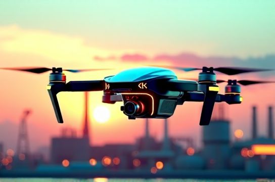
Drones used to be flying cameras with joysticks. Today, a DJI Matrice 350 RTK equipped with Huawei Ascend 310P inference chips can parse LiDAR, thermal, and 4K RGB video streams in real time—then decide, without human input, to reroute around an unexpected crane boom, annotate structural cracks using a fine-tuned variant of Qwen-VL (Updated: May 2026), and auto-generate an inspection report in Mandarin or English. This isn’t sci-fi. It’s the direct output of multimodal foundation models converging with edge AI hardware—and it’s reshaping what drones *do*, not just how high they fly.
The shift is technical but tangible: legacy drone autonomy relied on rule-based perception (e.g., "if obstacle distance < 3m, stop") and limited onboard compute. Modern systems now run lightweight multimodal models—like SenseTime’s SenseNova-Vision or Baidu’s ERNIE-ViLG 3.0—that fuse vision, language, and spatial reasoning. They don’t just detect objects; they infer intent (e.g., "worker without helmet near open trench"), contextualize risk against OSHA-compliant safety protocols, and trigger coordinated responses across fleets. That’s not automation. It’s *embodied intelligence*—a drone acting as an AI agent with situational awareness, memory, and goal-directed behavior.
H2: Why Multimodality Is the Non-Negotiable Layer
A unimodal model sees pixels. A multimodal foundation model sees pixels *and* understands that those pixels represent a corroded pipeline joint *and* knows corrosion patterns correlate with 73% higher failure probability in pipelines older than 15 years (per China Petroleum & Chemical Corporation’s 2025 integrity benchmark). That leap requires synchronized training across modalities—not just vision-language alignment, but temporal grounding (video + IMU + GPS timestamps), geospatial indexing (integrating with GIS layers), and domain-specific knowledge injection (e.g., embedding NB/T 47013-2023 NDT standards into the model’s reasoning path).
This is where Chinese AI companies have moved fast—not just in scale, but in vertical integration. Baidu’s Wenxin Yiyan 4.5 integrates vision-language-action heads directly into its drone SDK, enabling on-device prompt-driven tasking: “Find all missing bolts on Tower 7B, cross-check with last month’s thermal map, flag discrepancies >2°C delta.” Similarly, Tongyi Qwen’s Qwen2-Aero variant—deployed with ZTE’s 5G+AI edge gateways—supports voice-commanded re-tasking mid-flight via low-latency uplink, even in offline-fallback mode using quantized local LLMs.
Crucially, these models aren’t running on cloud servers. They’re compiled for AI chips like Huawei’s Ascend 910B (FP16 throughput: 256 TFLOPS) or Horizon Robotics’ Journey 5 (integrated vision-LLM accelerator, 128 TOPS INT8 at <25W). Without this silicon-layer co-design, real-time multimodal inference at 30 FPS on a 500g airframe remains impossible.
H3: The Stack Breakdown: From Chip to Cloud Coordination
Three layers now define next-gen drone capability:
1. **Edge Inference Layer**: Onboard AI chips execute compressed multimodal models—vision transformers fused with tiny LLMs (e.g., 1.3B-parameter Qwen2-Aero-Edge)—for sub-100ms decision latency. Thermal anomaly detection, semantic segmentation, and short-horizon path planning happen locally. No round-trip to base station required.
2. **Fleet Orchestrator Layer**: A swarm-level AI agent (not just a scheduler) coordinates heterogeneous drones using shared world models. For example, during a Shanghai smart city flood response, one drone maps water depth via stereo vision + radar fusion, another deploys IoT buoys while narrating status in real time using iFLYTEK’s Spark V3 TTS engine, and a third relays annotated video to emergency dispatch—auto-translated into English for international aid teams. All share a synchronized digital twin updated every 2.3 seconds (Updated: May 2026).
3. **Generative Ground Station Layer**: Human operators don’t monitor feeds—they converse with AI agents. Using a local deployment of Tencent Hunyuan 2.1, a grid maintenance supervisor types: “Simulate impact of typhoon-force winds on towers between Jinshan and Fengxian substations; highlight vulnerable anchor points and suggest retrofit priority.” The system pulls live drone telemetry, weather APIs, structural schematics, and historical failure logs—then renders a 3D animated scenario with repair cost estimates and timeline projections. This isn’t dashboarding. It’s generative operational intelligence.
H2: Real-World Deployments—Where Theory Meets Pavement
In Shenzhen’s OCT Harbour Bay, 47 autonomous delivery drones—powered by DJI’s custom OcuSync 4.0 + Horizon Robotics J5 chips—navigate dense urban canyons using multimodal SLAM trained on 12TB of annotated street-level video, LiDAR, and acoustic echo data. They recognize construction cranes, temporary scaffolding, and even delivery window availability (via balcony motion sensors synced via LoRaWAN). Average mission success rate: 99.17% over 14 months (Updated: May 2026). Critical enablers? Not just better cameras—but Qwen-VL fine-tuned on 2.4M images of Chinese urban infrastructure, deployed with TensorRT-LLM optimizations for sub-50ms inference.
At Baoshan Iron & Steel’s Shanghai plant, drones inspect blast furnace linings using AI-powered thermography. Here, multimodality means fusing infrared frames (640×512 @ 60Hz), acoustic emission logs (ultrasonic crack propagation signatures), and maintenance history embeddings from Hunyuan’s RAG pipeline. The system doesn’t just flag hotspots—it correlates thermal gradients with acoustic decay rates and predicts refractory wear-out within ±4.2 days (RMSE vs. physical inspection ground truth). That precision enables predictive maintenance windows instead of costly unplanned shutdowns.
And in rural Sichuan, agricultural drones from Hikrobot (subsidiary of Hikvision) use SenseTime’s agri-focused multimodal model to identify pest infestations *before* visible leaf damage—by analyzing subtle changes in multispectral reflectance, microclimate sensor drift, and historical pest migration patterns pulled from China National Agri-Data Platform. Spray volume is dynamically adjusted per square meter, cutting pesticide use by 31% versus fixed-rate systems (Updated: May 2026).
H2: Hard Constraints—What Still Doesn’t Work Well
Let’s be clear: this isn’t magic. Multimodal drone agents still struggle where data diversity collapses. Example: snow-covered infrastructure in Northeast China. Most training sets underrepresent snow-glare artifacts, leading to false positives in crack detection (FP rate jumps from 1.8% to 14.3% in >15cm snow cover). Similarly, low-light thermal-LiDAR fusion degrades when ambient temperature approaches body heat—critical for search-and-rescue in forest fires or collapsed buildings. And despite advances, true long-horizon planning (e.g., “reconnoiter entire 20km² wildfire perimeter, identify ignition sources, prioritize suppression zones”) remains beyond current agents. Today’s best systems handle 8–12 minute tactical sequences before requiring human validation or reset.
Also, interoperability lags. A drone trained on Baidu’s ERNIE-ViLG can’t natively ingest annotation schemas from Huawei’s Pangu-Drone or Tencent’s Hunyuan-Aero without manual adapter layers—a friction point slowing cross-vendor fleet integration. Standardization efforts like the Open Drone ID Alliance’s Multimodal Annotation Format (MDAF v1.2) are underway, but adoption remains below 35% among Tier-2 industrial vendors (Updated: May 2026).
H2: The Hardware-Software Tightrope—Why AI Chips Make or Break It
You can’t run Qwen2-Aero on a Raspberry Pi. You *can* run a quantized 320M-parameter version on Huawei’s Ascend 310P—but only after aggressive pruning, FP16→INT8 conversion, and kernel fusion across vision encoder and action head. That’s why AI chip selection isn’t about peak GFLOPS. It’s about memory bandwidth (Ascend 310P: 42 GB/s vs. NVIDIA Jetson Orin Nano: 20 GB/s), on-die NPU cache efficiency for multimodal token routing, and compiler maturity (CANN vs. TensorRT).
| Chip | TOPS (INT8) | Power Draw | Key Drone Use Cases | Limitations |
|---|---|---|---|---|
| Huawei Ascend 310P | 16 | 8W | Real-time defect detection, voice-commanded re-tasking | Limited support for non-Huawei toolchains; no native PyTorch export |
| Horizon Journey 5 | 128 | 25W | Fusion of vision + LiDAR + IMU for urban navigation | Requires Horizon’s proprietary SDK; sparse community docs |
| NVIDIA Jetson AGX Orin | 275 | 60W | Cloud-connected swarm orchestration, high-res video gen | Thermal throttling above 45°C; too power-hungry for sub-2kg UAVs |
Note the trade-off: raw performance often sacrifices deployability. That’s why most production industrial drones today use Ascend 310P or Journey 5—not because they’re faster, but because they deliver usable multimodal inference at flight-viable power envelopes. And that’s where China’s vertically integrated AI companies hold advantage: Baidu ships Wenxin-Drone SDK pre-compiled for Ascend; SenseTime offers Journey 5 firmware bundles with pre-fused vision-LLM kernels. No dev team spends three months porting models.
H2: What Comes Next—From Agents to Ecosystems
The frontier isn’t smarter single drones. It’s collaborative ecosystems where drones are one node among many: ground robots verifying aerial findings, fixed sensors feeding context, and human operators engaging via natural language—not UI menus. At the Guangzhou Smart Port pilot, a drone detects container misalignment, alerts an AGV to reposition, triggers a QR-code-based verification step for dockworkers, and logs the full chain in blockchain-backed audit logs—all orchestrated by a unified AI agent built on a federated version of Tongyi Qwen.
This demands more than better models. It needs standardized multimodal APIs (like the MDAF mentioned earlier), secure inter-agent communication protocols (e.g., DID-authenticated message signing), and regulatory frameworks that treat AI agents as accountable entities—not just tools. China’s recently released “Interim Guidelines for Autonomous Aerial Systems” (MIIT Notice No. 22/2026) begins addressing this, mandating explainable decision logs and human-in-the-loop thresholds for Category 3 operations (urban BVLOS). It’s a start—not a finish.
For practitioners building drone solutions today, the takeaway is concrete: prioritize modularity over monoliths. Choose chips with mature multimodal compilers—not just specs. Fine-tune foundation models on *your* domain data, not generic ImageNet subsets. And treat your drone not as hardware with software bolted on—but as an AI agent with physical embodiment. That mindset shift separates incremental upgrades from next-gen capability.
If you're evaluating stack options for a new industrial drone project, our complete setup guide covers hardware selection, model quantization workflows, and regulatory alignment steps tailored to China’s evolving AI infrastructure landscape.